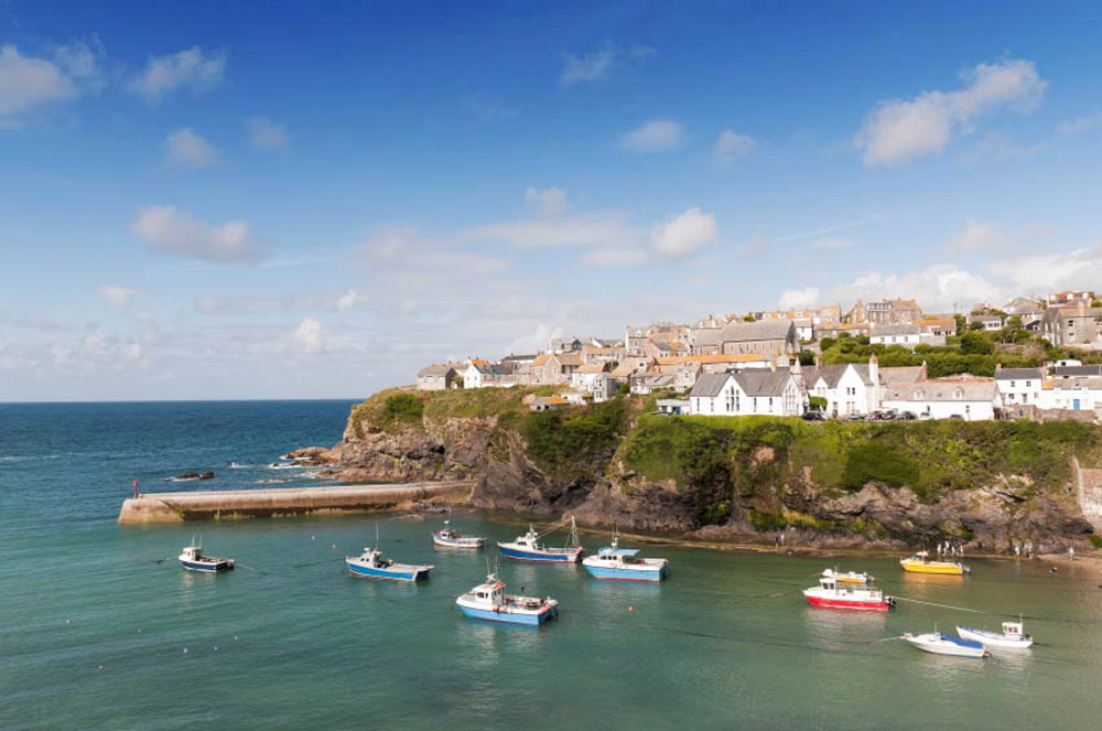
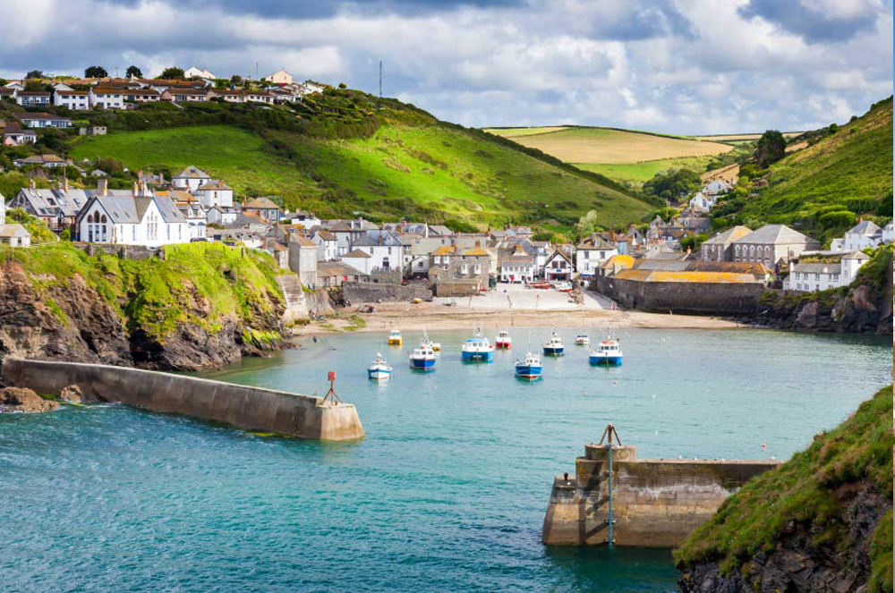
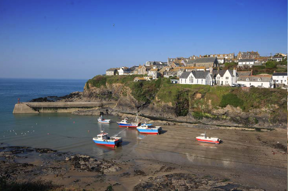
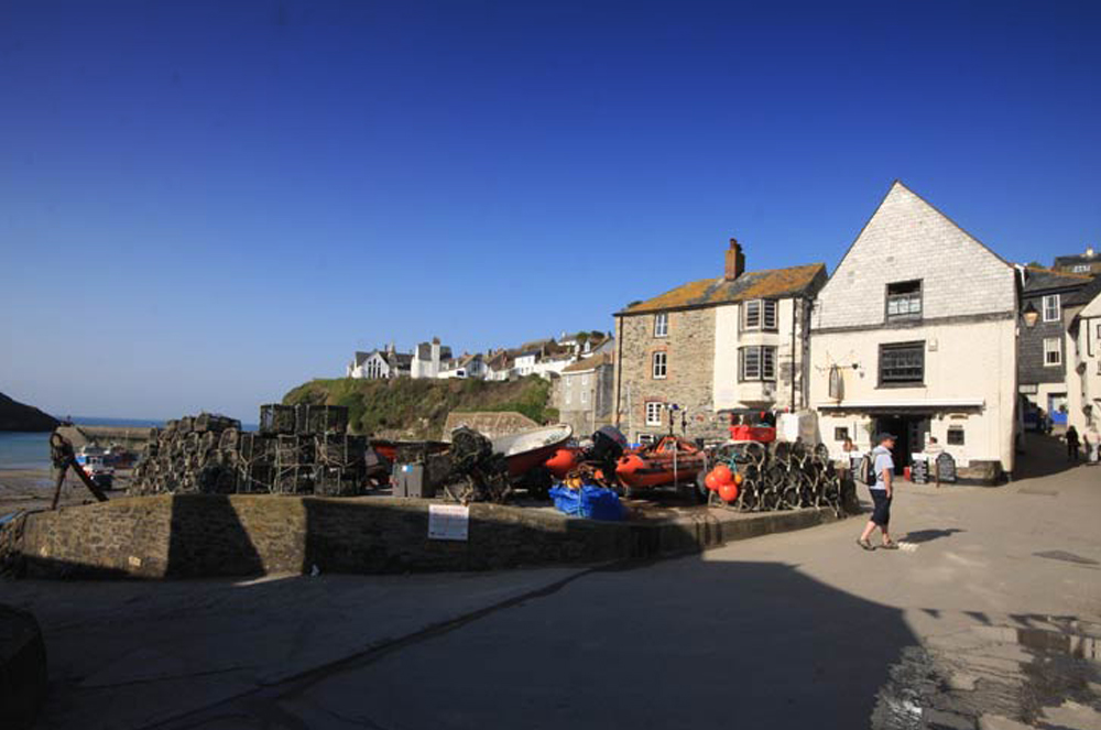

Port Isaac Harbour – North Cornwall
North Cornwall Coastal Guide
Fishing village · Holiday cottages · Film location · Heritage coastline
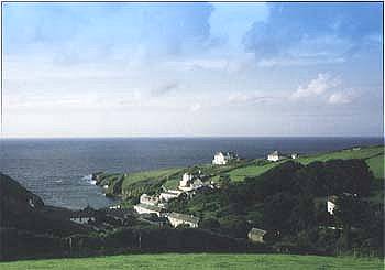
Port Isaac is one of Cornwall's most picturesque fishing villages, known for its narrow winding streets, historic harbour, and stunning coastal scenery. It is also famous as the filming location for the TV series Doc Martin.
The village sits within an Area of Outstanding Natural Beauty and remains a working fishing community surrounded by dramatic cliffs and coastline.
Set on the North Cornwall coast between Padstow and Tintagel, Port Isaac is easily reached from the A39 and makes an ideal base for exploring the wider Cornish coastline. Whether you're planning a short break or a longer holiday, the village offers a genuine mix of independent shops, seafood restaurants, sandy harbour beaches and dramatic coastal walking — all within easy walking distance of each other. This guide covers everything you need to plan a visit, from parking and accessibility to the best walks, viewpoints, and holiday accommodation in and around Port Isaac, Port Gaverne and Port Quin.
Port Isaac Harbour – North Cornwall
The small vibrant fishing village of Port Isaac is one of Cornwall's most well known and popular holiday destinations — famous for its winding streets, traditional fishermen's cottages, and the picturesque harbour, which is often used as a filming location for TV shows and movies, most notably the British drama Doc Martin. The village has a rich fishing heritage and is still home to a small fishing fleet. It lies on a stunning stretch of coastline, midway between Polzeath (and the Rumps headland to the west) and the ever popular village of Tintagel. Much of the coastline and surrounding countryside of Port Isaac is designated as an Area of Outstanding Natural Beauty and Heritage Coastline.
Port Isaac was a busy coastal port from the Middle Ages to the mid-19th century, when it was an active harbour where cargoes like stone, coal, timber and pottery were loaded and unloaded.
Fishing and fish-processing were also important, and today there are still fishermen working from here, although tourism plays an increasingly important role.
Most of the old centre of the village consists of 18th and 19th century cottages, many officially listed as of architectural or historic importance, along narrow alleys and 'opes' winding down steep hillsides. In recent years Port Isaac has become very popular due to its ongoing association with TV and film.
People flock to the village to wander through the narrow winding streets that lead down to the harbour. Port Isaac has many traditional whitewashed cottages and granite slate-fronted houses, and the village has many properties of historical importance.
Port Isaac also has one of the narrowest alleyways in Britain, Squeezy Belly Alley, located just off the Platt at the edge of the harbour. It is a very narrow thoroughfare leading away from the sea front.
Every day, including summer Sundays, Western National buses run between Bude and Newquay — via Boscastle, Tintagel, Port Isaac, Trelights, Polzeath, Rock, Wadebridge, and Padstow — with connections further afield.
For coast path walks, there are several convenient points at which to alight. You can walk the coast path in short sections by driving to a car park, taking the bus, and returning to your car on foot.
Beyond walking, Port Isaac's harbour is the starting point for local fishing trips, where visitors can head out to catch mackerel and, on a lucky day, spot dolphins or even a basking shark offshore. On summer evenings, the Platt is also a popular spot to catch a performance by the Fisherman's Friends, the village's own sea shanty group, who still sing here regularly in season. The harbour beach itself is dog-friendly all year round and safe for families at low tide, though there's no lifeguard cover, so it's worth keeping an eye on the tide times before settling in for the afternoon.
For a longer day out, Port Isaac makes a good base for exploring further along the coast. Polzeath, around four miles away, is the area's best-known surfing beach and a good option if you fancy trying a surf lesson, while the Camel Trail between Padstow, Wadebridge and Bodmin offers flat, easy cycling through some of North Cornwall's prettiest countryside. Closer to home, the two circular walks out to Port Gaverne and Port Quin — both covered in detail further down this page — are the best way to see the coastline beyond the village itself.
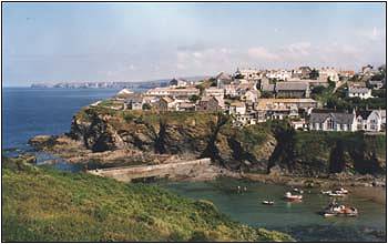
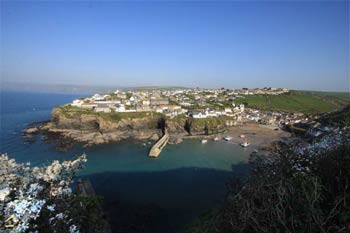
Two car parks serve the village. The Main Car Park on Trewetha Lane (B3267) has 139 spaces (5 disabled bays) plus a 40-space overflow, is open 24/7, and charges a fixed fee (larger vehicles over 5m pay more). It's roughly 725m walk into the village. The New Road / St Endellion Car Park is closer to the harbour and sits directly on the coastal path, but fills early in the season and suits longer stays better than a quick visit.
Public toilets are available at both car parks (coin-operated at the Main Car Park) and down by the harbour at the bottom of Roscarrock Hill. The Main Car Park also has a small café and a children's play area.
The Main Car Park has 5 dedicated disabled bays. Note that Port Isaac's streets are steep, narrow, and cobbled in places — Fore Street and Roscarrock Hill both involve a significant gradient down to the harbour, so wheelchair and limited-mobility access to the harbourside is challenging. The harbour toilets include accessible facilities.
Fern Cottage on Roscarrock Hill, used as Doc Martin's surgery on screen. The former RNLI boathouse on the Platt, now a gift shop. The Methodist chapel at the foot of Roscarrock Hill, now the Port Isaac Pottery and Café. Squeezy Belly Alley, one of Britain's narrowest thoroughfares.
The top of Roscarrock Hill gives the classic panorama over the harbour and the Platt. Walking down Fore Street from the main car park offers a gradually revealing view of the harbour as you descend. From the coastal path near the New Road car park, you get open sea views back along the coast towards Tintagel Castle and Trebarwith Strand.
One of the best surfing beaches in North Cornwall is Polzeath, 4 miles away. Dogs are not permitted on this beach from April to September, but the adjacent, wide beach of Daymer Bay (5 miles) has excellent, fine sand and is available to families and pets.
There are gardens to visit at Long Cross Victorian Gardens at Trelights, Pencarrow at Washaway near Wadebridge (12 miles), and National Trust Lanhydrock (15 miles).
In the season you can book fishing or scenic trips from Port Isaac harbour.
There are good opportunities for cycling along the Camel Trail — Padstow, Wadebridge, Bodmin — and cycles can be hired.
The nearest golf course is at St Kew, and there is an 18-hole course at Bowood near Camelford. There are also two well-known golf courses — the classic St Enodoc (5 miles) and Trevose (15 miles).
For leisure centres, there are Camelford Sports Centre (8 miles), Wadebridge Sports Centre (10 miles) and the Bodmin Leisure Centre (15 miles).
Two steam railways in the area are the Bodmin Steam Railway — standard gauge — (15 miles) and the Launceston Steam Railway — narrow gauge — (20 miles).
Visitors to Port Isaac usually approach the village via the B3267 (Trewetha Lane). It is advisable to park in the main car park on the right-hand side as you approach the village. Then follow Trewetha Lane into the village, either taking the shortcut directly into the village via Rose Hill, or walking along New Road to the T-junction, where you can join Fore Street for the more traditional walk along the edge of the harbour down into the village, enjoying the stunning harbour views. (more details below)
As an alternative, limited parking is also available adjacent to the coastal path on the outskirts of Port Isaac. Simply follow New Road towards Port Gaverne, passing the popular Nathan Outlaw Restaurant on the left — as you start to leave the village you will find the North Cornwall St Endellion pay-and-display car park on the left-hand side of the main road. The car park has stunning coastal and sea views and leads directly onto the coastal path — you can follow the coastal path round the headland directly onto Fore Street and then down to the harbour, enjoying the stunning sea views.
Bodmin Moor North Cornwall is the coast edge of Bodmin Moor with high, rocky cliffs. The whole area is very hilly, with deep valleys where little streams run down to the sea. Port Isaac and Port Gaverne are in two of these valleys — two separate communities.
Stone, ores, limestone, salt, and heavy commodities were shipped and trans-shipped in Port Isaac's little harbour until the 19th century. Then new ships, too large to be able to visit Port Isaac, were being used to trade further overseas. The railway and the motor lorry finally ended the coastal trade at the start of the 20th century.
Port Isaac became a holiday village. The name could mean 'The Corn Port' (yzack = corn). In 1340 it was registered as a fishing village. It was a sheltered harbour on an otherwise inhospitable coastline.
The village of Port Isaac was frequently used as a 'set' for filming the Poldark series, and 'Nightmare Man', where it was beautifully depicted, albeit as a village in the Hebrides!
More recently, Port Isaac has become associated with the TV series 'Doc Martin' (in which Port Isaac was transformed into the fictional Port Wenn) and the film 'Saving Grace'.
Doc Martin, a British television comedy drama, starred Martin Clunes as a doctor whose tactless manner causes mayhem in the small Cornish community of Port Wenn. Created by Dominic Minghella, the series was filmed on location in the village of Port Isaac, North Cornwall, with most interior scenes and production carried out in a converted barn at a local farm. Martin Clunes plays surgeon Martin Ellingham, whose glittering career comes crashing down around him when he develops a phobia which prevents him conducting operations.
Saving Grace was a comedy/crime film, starring Brenda Blethyn, Craig Ferguson and Martin Clunes, filmed in 2000. After Grace Trevethyn's husband commits suicide, he leaves her in economic ruin, facing the loss of her house because of the money her husband owed. Together with her gardener, she uses her plant-cultivation ability to grow marijuana.
Amy Foster, or Swept from the Sea as it was called on release in America, is a 1997 film based on a 1903 story, Amy Foster by Joseph Conrad. It stars Rachel Weisz, Vincent Perez, Ian McKellen, Kathy Bates and Zoe Wanamaker, and was directed by Beeban Kidron. The story concerns a Russian, unable to speak English but able to play chess, shipwrecked on the coast of Cornwall on his way to America.
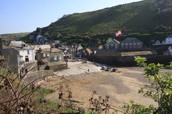
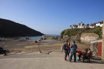
Port Isaac is divided into two distinct areas:
The top of the village — Trewetha Lane and New Lane, forming the main route through the village to Port Gaverne and the coastal road.
The Harbour — with Fore Street leading down the eastern edge and Roscarrock Hill forming the western side of the inlet.
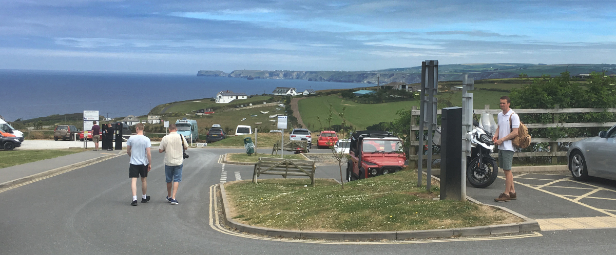
Port Isaac has two car parks, both with stunning coastal views. As you enter the village along Trewetha Lane (B3267), the "Main" Parish Council-run car park is found on the right-hand side of the road — literally the first thing you encounter in the village. A staggered, open-plan car park with amazing views across Port Gaverne and Port Isaac Bay towards Tintagel Castle and Trebarwith Strand. The car park has 139 parking spaces in the main section (including 5 disabled bays), plus a further 40 bays in an overflow site. It's open 24 hours a day, 7 days a week, with a small café and toilets on site (disabled facilities available). In peak season it's now possible for visitors to purchase parking tickets in advance via the Parkonomy website.
There are a small number of on-street parking spaces along New Road, but these are best left for locals, who use them for trips to the local shops etc.
The main village is located approximately 800m from the car park. Simply follow the footpath out of the car park, past a small children's play area, onto Trewetha Lane and New Road, which you follow down to the top section of the village. There is a Co-op on Trewetha Lane for drinks, snacks etc. For the main route to the harbour, follow New Road to the T-junction, where it meets Fore Street and Back Lane — either of which will take you down the hill into the bottom of the village and the harbour.
Rose Hill, on the left of Trewetha Lane just before the Co-op, provides a short cut down to the bottom of Fore Street, just above the harbour. The route is signposted and offers a steep but shorter route to the bottom of the village.
Fore Street, running along the cliff edge down to the harbour and the Platt, is the main street in Port Isaac. The left-hand side of the street as you walk down to the harbour is lined with small cottages, holiday homes, small gift shops, galleries and tea rooms.
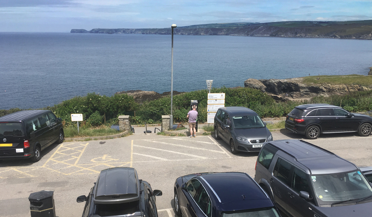
Port Isaac's second car park is the St Endellion, or New Road, Car Park, located on the left as you leave Port Isaac on the B3267 towards Port Gaverne. The Cornwall Council-run facility has approx. 100 spaces. Set on the cliff edge, adjoining the coastal path, the car park is closer to the village but is generally used as long-term parking by visitors staying in holiday cottages. It's very popular and frequently full by early morning. There are two tiers, each with its own entrance — the second entrance, 20m further down on the left, takes you into the larger parking areas. Online payment by mobile phone is available, and there are toilets on site. From the car park you can follow New Road (approximately 50m) back to the T-junction at the top of Fore Street, or follow the coastal path that runs through the bottom edge of the car park along the cliff tops to Fore Street — enjoying the spectacular coastal views at the entrance to the harbour.
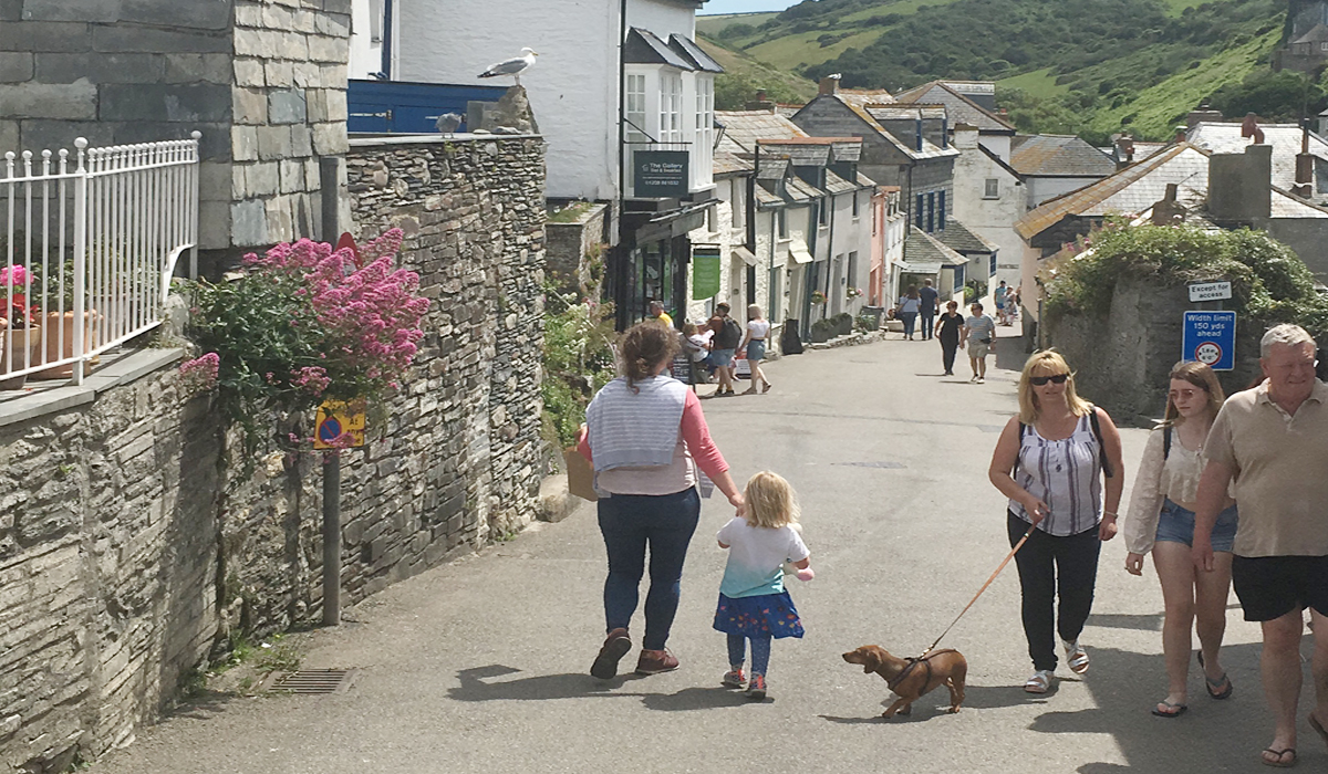
Fore Street — the main route to the harbour in Port Isaac. Fore Street is a busy thoroughfare, lined with cafés, galleries and tourist shops.
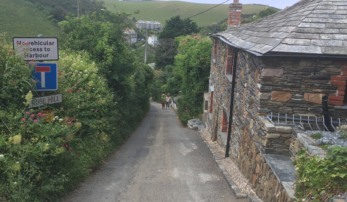
The entrance to Rose Hill — a 'short cut' down to the harbour from Trewetha Lane. Rose Hill winds through the 18th and 19th century cottages at the heart of the old village, joining Fore Street just before the harbour.

Bottom of Fore Street as it approaches the Platt.
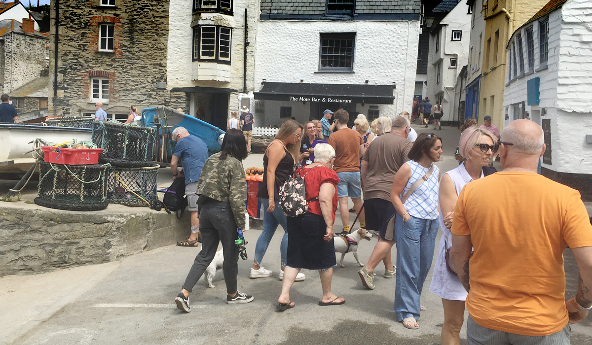
The Platt.
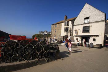
At the bottom of Fore Street is the historic core of the village, opening out onto 'The Platt', a small open area and slipway where local fishermen store their crab pots and land their catches of fish, crab and lobster. The RNLI operates an inshore D-class lifeboat from a building on the Platt. (The original Port Isaac lifeboat station was established in 1869 following the delivery of two lifeboats, Richard and Sarah. The former boathouse was until recently the village Post Office, but is now a gift shop.) The Platt is a vibrant hive of activity as tourists mix with locals. Food has become the mainstay of the Platt, with an abundance of cafés, seafood restaurants, tea rooms, and the Golden Lion harbourside pub (dog-friendly), with an outside patio area where you can enjoy locally sourced food and views of the beach and harbour. Nathan Outlaw's Fish Kitchen is situated next to the inshore lifeboat station.
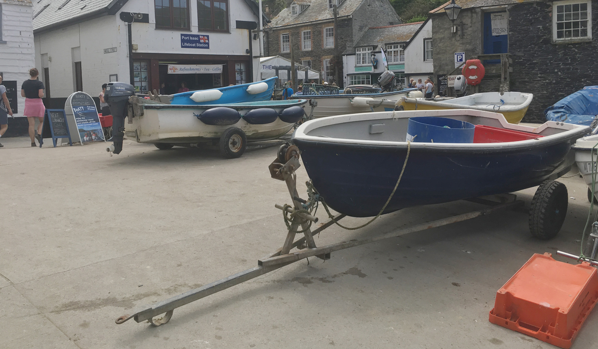
Fishing boats on the Platt.
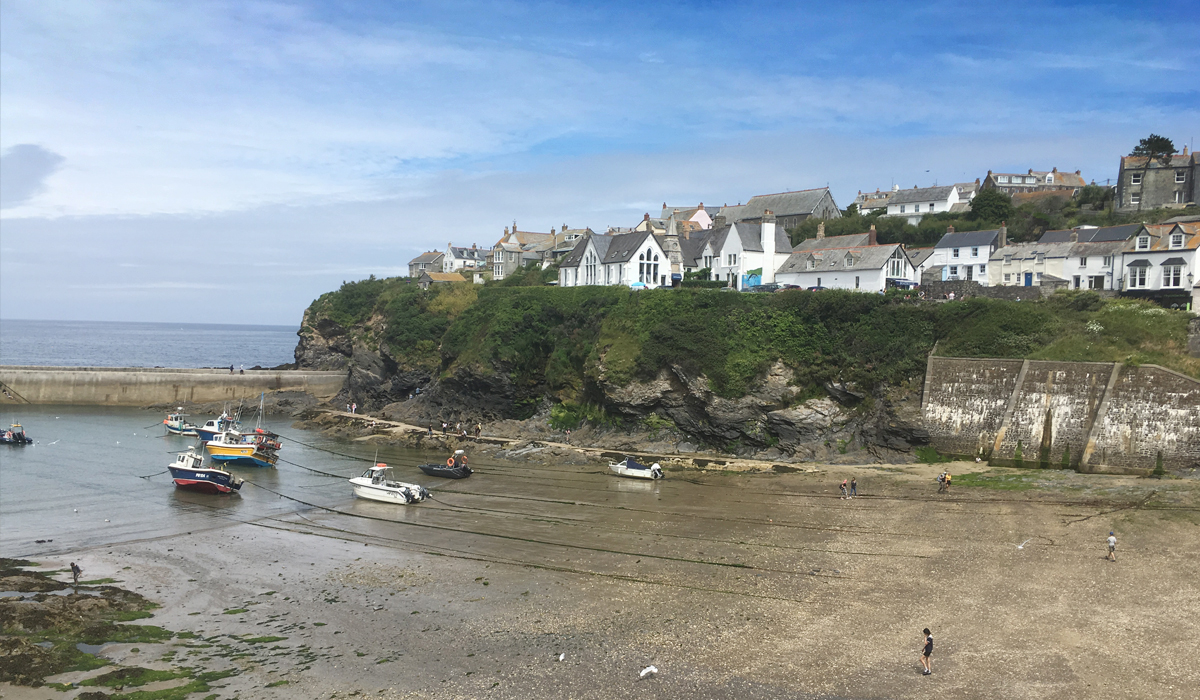
Port Isaac harbour and beach.
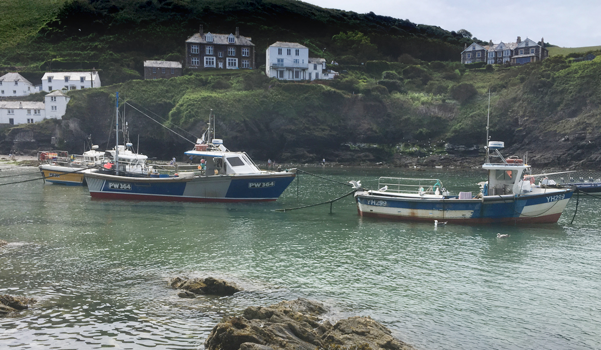
Fishing boats, Port Isaac harbour.
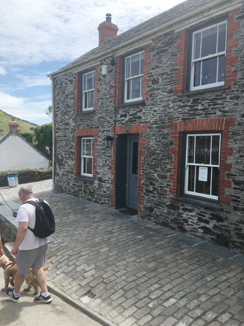
Fern Cottage, "Doc Martin's surgery", on Roscarrock Hill.
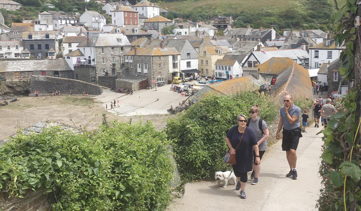
Roscarrock Hill.
From the Platt, you start to climb up Roscarrock Hill, forming the western edge of the harbour. The small Methodist chapel at the bottom of the hill is now the Port Isaac Pottery and Café, selling a nice selection of locally produced pottery and artwork. Roscarrock Hill rises up the edge of the harbour towards the cliffs and coastal path, where you can enjoy the iconic views of the harbour and village. Fern Cottage, used as Doc Martin's surgery in the popular TV series, is located halfway up Roscarrock Hill.
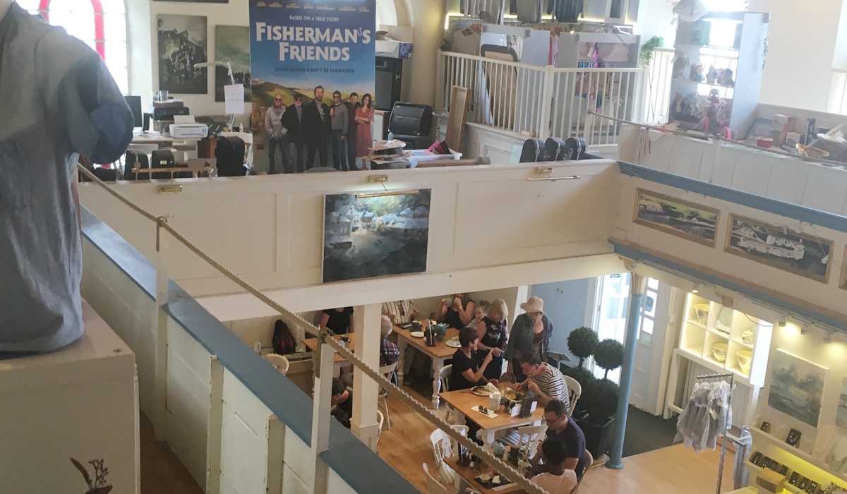
Port Isaac Pottery and Café on Roscarrock Hill.
This is the classic Port Isaac walk — out to Port Quin along the direct inland Postman's Path across Roscarrock Farm, then back along the dramatic coastal cliff path via Kellan Head and Pine Haven, with an optional spur out to Doyden Castle. Allow 3–4 hours at a comfortable pace, take food and water, and wear proper footwear — the return leg has steep, unfenced sections. The whole route is roughly 5 miles / 8km. Route plotted from a GPS-tracked walk of the actual path.
Start at the Platt, at the harbour. Cross to the south side and head up towards the bottom of Roscarrock Hill — the start of the climb out of the village.
50.592143, -4.83206 → 50.591942, -4.832311
A stile marks the start of the Postman's Path proper, leaving the lane and striking out across the fields above the village rather than following the coast. The path soon reaches a field boundary, then drops to cross a small stream at the bottom of the valley.
Stile: 50.592378, -4.83426 · Field boundary: 50.591602, -4.837851 · Stream: 50.58946, -4.840145
From the stream, the path climbs to the corner of a field and follows the edge of Roscarrock Farm, skirting the working farmland on a clear, well-trodden field-edge path for the better part of a mile.
Corner of field: 50.59066, -4.842929 · Edge of farm: 50.589834, -4.844124 · Path around farm: 50.592155, -4.848214 → 50.591951, -4.852041
The path continues west, passing a solitary cottage by the road before dropping down into Port Quin itself — the near-deserted hamlet known locally as "the village that died".
Footpath: 50.589897, -4.858711 · Cottage: 50.589107, -4.864802 · Port Quin: 50.589096, -4.867338
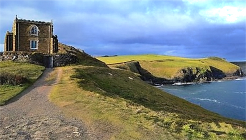
A short spur leads out onto the headland to Doyden Castle, the Gothic folly built around 1830. On the way, a natural viewpoint looks out to The Rumps headland further down the coast — worth the short detour before doubling back to Port Quin to rejoin the main route.
View of The Rumps: 50.588458, -4.871604 · Doyden Castle: 50.589364, -4.873286
The return leg joins the South West Coast Path proper at Port Quin, climbing the cliff path out of the cove and rounding Kellan Head — the first, and one of the finest, viewpoints of the return journey, looking back over Port Quin's natural harbour.
Cliff path out: 50.591053, -4.870071 → 50.592219, -4.871363 · Kellan Head: 50.594964, -4.869695
This is the most demanding stretch of the walk — a genuine rollercoaster of steep climbs and descents as the coast path winds around a series of small coves and headlands, eventually dropping down to Pine Haven, where a short path gives access to a small rocky beach.
Pine Haven: 50.593302, -4.842014
From Pine Haven the path climbs one final time towards a viewpoint looking straight down over Port Isaac harbour — arguably the best view of the whole walk, and the reward for the effort of the rollercoaster section.
View over the harbour: 50.593936, -4.83572
Just below the viewpoint sits Bert Large's Chair — a bench used in several episodes of Doc Martin by the character Bert Large (played by Ian McNeice). From here the path descends Roscarrock Hill, back into the village.
Bert Large's Chair: 50.593313, -4.835457 · Roscarrock Hill: 50.592337, -4.834852 → 50.592327, -4.833767
The final descent brings you past the bottom of Roscarrock Hill and back to the Platt, completing the circuit at the harbour where you started.
Finish: 50.592143, -4.83206
Route plotted from GPS track. Map data © OpenStreetMap contributors
The neighbouring village of Port Quin, to the west of Port Isaac, is a quiet, near-deserted hamlet with no shops and no public toilet — not even a tea room! It sits within a natural coastal inlet, sheltered by Doyden Point, and today consists of just a handful of cottages and converted fish cellars, most owned by the National Trust and let as holiday accommodation.
Port Quin's beach is a small, sheltered cove — a sloping area of shingle and stones above the high-water mark, with a stream crossing the sand. At low tide the sea retreats over 200m out into the inlet, revealing patches of fine yellow sand, rocky ledges, small caves, and plenty of rock pools to explore. At high tide, when the rocky shoreline is covered, conditions are often calm and sheltered enough for swimming and snorkelling — though it's best to stay clear of the mouth of the inlet, where currents can be strong. There are no lifeguards, toilets, or other facilities at the beach itself, so it suits confident swimmers and families happy to be self-sufficient for a few hours.
Port Quin sits directly on the South West Coast Path and is a popular staging point on the "Postman's Path" walk from Port Isaac harbour. The walk starts at Roscarrock Hill Lane, follows the Postman's Path across the headland into Port Quin, then joins the coastal footpath east to Kellan Head. From there the path becomes a genuine "roller coaster" of climbs and descents, dropping steeply to Reedy Cliff before climbing out again above Downgate Cove, then continuing above Greengarden Cove towards Pine Haven Cove — an ideal spot for a picnic or a swim — and on to Lobber Point, from where the path leads back into Port Isaac with classic views of the harbour. In the other direction, the coast path continues west from Port Quin towards Doyden Point, Epphaven Cove, and eventually Polzeath. The walk is perfect for a sunny afternoon, but take food and water, and be prepared for some strenuous sections — particularly the steps at Reedy Cliff.
Port Quin was once a working fishing and pilchard-processing harbour, with a small mining industry alongside it. The hamlet earned its haunting nickname, "the village that died," after being abandoned on two separate occasions — once when the local pilchard fishery failed, and again after a violent storm, some accounts date it to the late 17th century, claimed the lives of the village's fishing fleet. With the men lost at sea, the women and families left behind could no longer sustain the village, and the cottages gradually fell into ruin. What survives today — a scatter of cottages and old fish cellars — is now cared for almost entirely by the National Trust.
On the headland above the cove stands Doyden Castle, a Gothic-style folly built around 1830 by Samuel Symons, a Wadebridge businessman known for hosting extravagant parties there. It's now let as a National Trust holiday cottage. Port Quin's unspoilt, atmospheric setting has also made it a popular filming location — most notably for the 1970s BBC drama Poldark, in which Doyden Castle appeared as Dr Dwight Enys's home, and for the 1997 film Amy Foster.
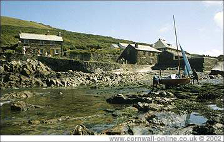
Port Quin Harbour — low tide.
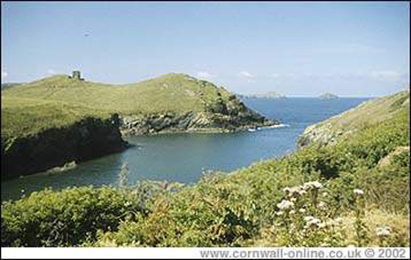
Coastal path at Port Quin, looking across the inlet to "Doyden Castle" on Doyden Point.
A small National Trust car park sits at Port Quin itself, with unmarked bays and an overflow field nearby when full — it's often at capacity by late morning in season. Parking is free for National Trust members but chargeable for everyone else (bring change). Alternative NT car parks are available at Pentire and Lundy Bay if Port Quin is full.
There are no public toilet facilities at Port Quin itself, and no shop or café — it's a genuinely unspoilt hamlet. An information board and map are provided in the car park. The nearest facilities are back in Port Isaac.
Access around the site includes ramps, steps, and uneven natural surfaces, with no mobility equipment available to hire on-site. The Postman's Path route from Port Isaac is steep and not suitable for wheelchairs or limited mobility; arriving by car to the Port Quin car park is the easier option.
Doyden Castle, a Gothic-style folly built around 1827 on the headland, now a National Trust holiday cottage. A small cluster of former fishermen's cottages and stone pilchard cellars by the beach, also NT holiday lets. The remains of the old Gilson's Cove mine workings nearby.
Doyden Castle occupies the standout viewpoint, perched on the headland with sea views in multiple directions. The South West Coast Path either side of the inlet gives classic Cornish clifftop views, and looking back into the cove from the coast path captures the whole sheltered inlet and its cluster of cottages at once.

Port Gaverne is a small, picturesque fishing cove located in the parish of St Endellion, on the north coast of Cornwall, England. It has a rich and diverse history that dates back to prehistoric times and has been shaped by various human activities including mining, fishing, and smuggling.
Port Gaverne developed in the nineteenth century as a slate, coal, and limestone handling port where shipbuilding also took place — the large buildings have all been converted into holiday accommodation.
Port Gaverne's beach sits in a narrow, sheltered, north-west facing cove owned by the National Trust and largely unchanged for hundreds of years. At high tide there's a band of shingle above the high-water mark — unusually made up mostly of flint rather than the golden slate-and-shell sand typical of North Cornwall, a legacy of flint once being used as ballast on ships collecting Delabole slate. As the tide drops, a sandy beach is revealed alongside flat rocky areas, caves, and an abundance of rock pools, making it a popular, safe spot for families and one of the best rock-pooling beaches in the area. A stream crosses the beach, and access down to the sand is via a gentle slipway, making it accessible for most visitors, though wheelchair users may find the final stretch challenging. At high tide the calm, sheltered water is good for swimming, kayaking, paddleboarding and diving, though the central part of the cove is kept clear for local fishermen launching boats — a condition attached when the beach was gifted to the National Trust — so it isn't the best spot to swim directly off the slipway. It's also one of the few dog-friendly beaches in the area, with dogs allowed all year round.
The South West Coast Path runs directly through Port Gaverne, linking it to Port Isaac a short walk to the west and continuing on towards Tintagel to the east. The stretch above the cove offers some genuinely dramatic clifftop walking, with views back across the bay and out to sea. A short, gentle circular walk links Port Gaverne and Port Isaac via the valley and headland above, while a longer circular route continues around the bay towards Barretts Zawn for those wanting more of a stretch. Walkers continuing east along the coast path from Port Gaverne pass towering cliffs, the long sandy beaches of Tregardock and Trebarwith Strand, and the slate pinnacles of the old coastal quarries, eventually reaching Tintagel.
Slate from the nearby Delabole Quarry was loaded here into the heavy sailing sea ketches, which were broad enough to rest upright on the beach between tides. This is now a peaceful spot with little commercialisation.
The area around Port Gaverne has evidence of human habitation from the Neolithic and Bronze Ages, with the presence of ancient field systems and the remains of a fogou (an underground chamber) nearby. The natural harbour would have provided shelter and resources for early settlers.
During the medieval period, Port Gaverne may have been used for the export of tin and copper from nearby mines. The name Gaverne is thought to derive from the Cornish "Karn Hun," meaning rocky haven — locally it's still sometimes spelled "Port Gavern" and pronounced "gay-vern." The area was part of the manor of Tintagel, which belonged to the Earl of Cornwall.
Through the 15th and 16th centuries, the cove became a haven for smugglers due to its secluded location and proximity to the coastal pathways used for moving contraband goods. The real heyday of Port Gaverne began with the expansion of the slate and serpentine mining industries in the 18th and 19th centuries. The harbour was developed to export these materials, and the village grew to support the miners and their families. The quaint cottages and warehouses that line the harbour today were built during this period.
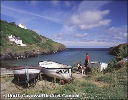
Port Gaverne.
Port Gaverne.
Port Gaverne's remote location made it an ideal spot for smugglers, and it is said that the tunnels and caves surrounding the area were used to store smuggled goods. The smuggling trade was so prevalent that the local pub, The Port William Inn, was named after a famous smuggler, William Oliver.
Fishing has always been an important part of Port Gaverne's economy, with the village's fleet contributing to the catch of mackerel, pilchards, and herring. However, the decline of the mining industry in the 19th century led to a greater reliance on fishing.
The treacherous coastline around Port Gaverne has seen its share of shipwrecks. In 1809, the "Phoenix" wrecked nearby, resulting in the loss of all but one crew member. This incident prompted the construction of a coastguard station and the Port Gaverne Hotel (now a private residence) to house the coastguards. In response to the high number of shipwrecks, the Port Isaac Lifeboat Station was established in 1869, with the first lifeboat stationed at Port Gaverne. The Trevose Head Lighthouse was built in 1847 to guide ships safely along the coast.
As the local mining and fishing industries declined, the village turned to tourism. The natural beauty of the area, the sandy beach, and the mild climate have made it a popular holiday destination. The harbour is now used mostly by small pleasure craft and for local fishing. Today, Port Gaverne is a quaint and peaceful village with a small number of permanent residents. It attracts tourists and holidaymakers seeking a tranquil escape and the opportunity to explore the stunning coastal scenery, including the South West Coast Path, which passes through the area. The village is also popular with artists and photographers due to its picturesque setting, and fans of Doc Martin may recognise the cove, which has appeared in the series on several occasions.
Roadside parking at Port Gaverne itself is very limited — space for roughly 8–10 cars. Most visitors park in Port Isaac instead; the New Road/St Endellion car park is the closest, around a 5-minute walk away, though the road down into Port Gaverne is steep.
Toilets are located next to the car park up the hill towards Port Isaac. Port Gaverne itself has a pub and seasonal beach shop; the fuller range of shops, cafés and restaurants is a short walk away in Port Isaac.
A gentle slope leads down to the sand, which suits most visitors, but the final stretch to the beach can be difficult for wheelchair users, and the road down from Port Isaac is steep and not considered wheelchair-suitable. There are some designated disabled parking spaces near the beach.
The Port Gaverne Hotel, a former coastguard building turned traditional pub and restaurant. The converted slate and shipbuilding warehouses lining the harbour, now mostly holiday accommodation. The Port William Inn, named after a local smuggler.
The Bay Hotel's clifftop position to the north of the beach gives sweeping views over the cove. The coast path linking Port Gaverne to Port Isaac offers changing sea views along the headland, and at low tide the sheltered cove itself, framed by cliffs on both sides, is the classic Port Gaverne photograph.
Cottages, B&Bs, hotels, camping and glamping in and around Port Isaac and Port Gaverne.
See Where to StayCornwall Online · St Ives, Cornwall · Helston · Padstow · The Lizard Peninsula